
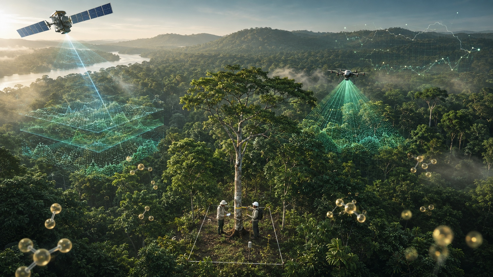
A tonne of CO₂ isn't something you can see, weigh, or hold in your hand. It's an invisible gas, diluted in the air. And yet it sells, sometimes for more than $20 a tonne. So how do you turn a tree standing in an Ivorian forest into a carbon credit ready to be sold on the market? How do you turn something invisible into a valuable asset that airlines, energy giants, industry, tech, every polluting sector, and states themselves, will then scramble to buy?
The answer is simple: MRV (Measurement, Reporting and Verification), a process that measures the carbon stored or avoided by a project, reports it in a file detailing the results and the methodology, and then has it verified by an independent third party. It's one of the most technical subjects in carbon finance, and probably the most decisive. Because it's MRV, and MRV alone, that decides whether a credit is worth money or worth nothing at all. Without solid MRV, there's no turning a forest into an asset.
In this article, we're going to take MRV apart, piece by piece.
MRV, what does it actually mean?
MRV stands for Measurement, Reporting, Verification. Three clearly distinct steps:
- Measure: quantify the carbon stored or avoided. This is the scientific part.
- Report: record those figures in a standardised, traceable format. The purpose of this step is to let other people review the results and, ultimately, validate or challenge them.
- Verify: have the results checked by an independent third party that had no part in the project.
But why three separate steps? Quite simply because you can't check your own work. The one who measures can't be the one who validates. That's the difference between merely claiming you avoided 1,000 tonnes and being able to say that an accredited auditor confirmed 1,000 tonnes were genuinely avoided. The first statement is worth nothing on the market; the second is worth a lot.
The difficulty of measuring
Measuring the carbon in a forest isn't simple. The empirical process is, in fact, long and costly. To understand why, you have to follow the path that leads from a tree to a tonne of CO₂.
You never weigh carbon directly. You deduce it, and here's the chain:
- You measure the diameter at breast height (DBH) of the trunk and the height of a tree.
- You apply an allometric equation, a mathematical formula that links these dimensions to the tree's wood mass. These equations are built by actually felling and weighing trees, then generalising. The most widely used in the tropics are Chave's equations, built from several thousand trees actually felled and weighed across the tropics.
- You then convert that wood mass into carbon mass. A dry tree is approximately 47% of carbon.
The formula is as follows:
C = BS × FC
where:
- C represents the mass of carbon;
- Bs represents the dry biomass;
- FC represents the carbon fraction of the biomass, generally fixed at 0.47.
Finally, you convert the carbon into CO₂. To do this, you multiply the carbon mass by 3.67. That number is the ratio of molecular masses: a CO₂ molecule weighs 44 and a carbon atom weighs 12, so 44 divided by 12 gives 3.67.
The formula is :
CO₂ = C × (44/12)
Therefore :
CO₂ = C × 3.67
The key thing to remember is that at each step, you introduce a bit of uncertainty. The allometric equation is never perfect, nor is the diameter measurement, and the 47% figure is an average. On top of that, since you can't measure every tree in a forest of several thousand hectares, you have to extrapolate from a sample. Which adds even more margin of error.
The tools
To measure an entire forest, you combine several scales of measurement. We'll go through them from the simplest to the most advanced.
The field (plots): you mark out sample parcels, measure every tree in them, and extrapolate to the rest. This is the reference measurement, but it has a major limitation. Covering every hectare of a country by hand would be far too slow and far too expensive. Sample field plots often cover less than 0.005% of the territory, so the results of the extrapolation are uncertain. Forest inventories often work this way, delivering an estimate but not a detailed, current map. Field data alone falls well short of what's needed at a country's scale.
The optical satellite: satellites like Sentinel-2 or Landsat photograph the Earth continuously. They're very good at detecting change in forest cover over time. Their two weak points: clouds prevent them from photographing the forest cover, and on their own they can't tell you how much carbon an intact forest contains, nor how much it loses when it's cut. For that, you have to convert the lost hectares into tonnes of CO₂ using an emission factor, that is, the carbon stored per hectare. But those factors are often inaccurate, and even when they're correct, some uncertainty always remains, because aerial imagery can't see the biomass beneath the canopy.
The radar (Sentinel-1): where optical is blinded by clouds, radar sees anyway. It sends out its own waves toward the ground, which lets it pass through cloud cover and operate day and night. That's an asset in the tropics, where the sky is rarely clear. It complements optical by spotting deforestation even when clouds hide the ground.
LiDAR: a sensor, like GEDI or ICESat-2, that sends laser pulses and measures the time they take to return, which reveals the vertical structure of the forest. This gives you the height of the trees. It's exactly the missing link between the flat image seen from the sky by an optical satellite and the calculation of the volume of biomass stored in the forest.
Artificial intelligence: these smart machine learning models let us orchestrate the different components (optical, LiDAR, field). A machine learning model learns the link between what's observed from space and the amount of carbon on the ground, drawing on reliable reference data. Then the model is calibrated with field data. Once it has learned the link between observation and carbon stock, it produces a carbon map covering millions of hectares. This is what ties together everything we've discussed above.
The important thing to remember here is that none of these tools is enough on its own. The field measures accurately but can't cover a whole country. The satellite covers everything but doesn't measure carbon. LiDAR reads the structure of the trees but doesn't observe everywhere all the time. And AI measures nothing by itself: it connects the other three and scales up their results. The strength of a modern MRV system is the fusion of these four tools.
What breaks most often
In practice, MRV systems almost always fail on the same points.
First, measurements are based on data that's too old. Many national figures rest on field inventories more than ten years old, or on an outdated biomass map. So you're working from stale data that poorly reflects the state of the forests, and the uncertainty of the measurements is therefore high.
Second, borrowing instead of measuring. For lack of allometric equations calibrated on local species, many countries use generic formulas, valid on average across the tropics but lacking precision for the country's specific flora. The absence of equations specific to Africa is a major source of uncertainty about the tonnes actually stored. So the figure isn't really measured; it's approximate.
Finally, uncertainty explodes for lack of relief. Without measuring the height and vertical structure of the trees, that is, without LiDAR, the margin of error can become enormous. And as we saw: high uncertainty is paid for in lost credits.
The takeaway
These three weaknesses come down to the same thing: approximating instead of measuring. There's a lack of real, local, current measurement. That is exactly what a modern MRV system sets out to fix.
How TerraKora measures: AlphaKappa™
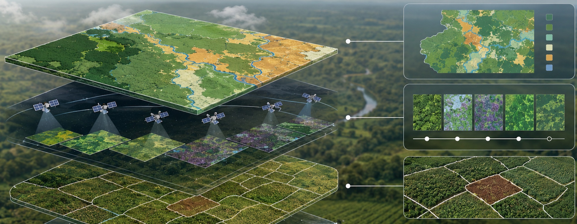
The approach of our engine, AlphaKappa™, solves the problems raised above. It combines satellite analysis (optical satellite + radar + LiDAR), field data and machine learning to track carbon stocks in near real time. Our model processes terabytes of geospatial data, field measurements and environmental variables to deliver carbon assessments that meet the highest international verification standards.
The benefit isn't only technical, it's also economic. Conventional verification of a carbon project can take two to three years. By automating measurement, we bring that timeline down to a few months. And a project generates no revenue until it's verified. Shortening that delay means unlocking sooner the financing that would otherwise stay frozen.
Validation by an independent third party: verification
Once the carbon is measured, it has to be reported: recording the figures and the method in a standardised, traceable file that anyone can review and challenge. That file is what the auditor will comb through.
Once you've measured and reported, the V remains: verification. It's this step that gives the credit all its value.
Before a single credit exists, the file passes into the hands of an independent auditor called a VVB (Validation and Verification Body). This is an independent external auditor, accredited by the certifiers such as Verra or Gold Standard to review projects. Its job is to check that the method was correctly applied, that the figures hold up, and that nothing has been inflated.
It's precisely this scrutiny that turns a declaration into a tradeable asset. The very first credits eligible for CORSIA in history, Guyana's REDD+ credits, sold for $21.70 a tonne, well above comparable voluntary credits. Why? Because the rigour of measurement and verification required was higher. In short, MRV is literally what sets the price.
In closing: whoever measures is in control
MRV isn't only a technical matter. It's really a question of power.
Today, many African states have built their measurement systems with outside funding and with methods and tools designed in Western countries. The problem isn't the funding, but rather the lack of control over the data and over how the forest is valued. With sovereign MRV, the data stays national, and the state negotiates its carbon credits from a position of strength, stepping out of the price-taker box.
Guyana is the proof. By mastering its own forest monitoring, it became the first country in the world to make a corresponding adjustment under the Paris Agreement, and the first able to sell its credits to airlines anywhere in the world. That's no accident: it's the result of sovereign MRV.
The bilateral agreements under Article 6.2 of the Paris Agreement demand solid national MRV: without it, a country signs with its eyes closed. The European regulation on cocoa asks the same thing under another name: EUDR (EU Regulation on Deforestation and Forest Degradation), proving that each imported agricultural product does not come from deforested land. Every time, it all rests on a single capability: measuring well, at home.
MRV, then, isn't just one subject among others in carbon finance. It's the foundation on which everything else stands: the credits, the markets, the agreements between states. Without it, a tonne of CO₂ is only a claim. With it, it becomes an asset. And the real question, for Côte d'Ivoire as for the rest of the continent, isn't whether its forests are worth something, it's who will hold the machine that measures it. That is exactly what TerraKora wants to place in the hands of African states.